
Summerville Previous Residents by Era
A backward address trail changes source as it moves through time. The current property card leads to the most recent recorded transfer. The Register of Deeds online index then supports party, date, category, and book-page searching, but it does not publish its online start or cutoff year. That gap matters. When an online result stops, the Dorchester ROD land archive library and the South Carolina Archives supply the documented next channels rather than a guess about what is missing.
| Source | Time period | Where held | What it can establish |
|---|---|---|---|
| Current CAMA property record | Current tax data | Dorchester Assessor | Parcel, recorded owner association, situs and mailing fields, and a last-sale pointer. |
| ROD online index | Online limits not published | Dorchester ROD | Digital party, date, category, book, and file research, subject to processing and coverage limits. |
| Dorchester conveyances | 1897 to 1920 | South Carolina Archives | Post-formation county land history. |
| Berkeley and Colleton transcripts | 1885 to 1897; 1867 to 1897 | South Carolina Archives | Parent-county land bridge for an older Dorchester trail. |
| Tax duplicates | 1897 to 1923; 1899 to 1973 | South Carolina Archives | Historic taxpayer and land-reference clues. |
| Federal census | Released through 1950 | Library databases and census resources | Household and place at an enumeration date, checked against the address carefully. |
| Town and local archives | Collection specific | Summerville and Timrod collections | Municipal process, clippings, photos, ledgers, and local context. |
For a recent transfer, start with CAMA and the ROD. For a 1897 boundary-era question, move promptly to the Archives guide. For past residents rather than past owners, look for an actual dated directory, census record, obituary, or probate source that fits the time period. Note: The online ROD index is a convenience search, not a published promise of complete historical coverage.
Start a Summerville Previous Residents Trail
For the Dorchester part of Summerville, use the CAMA Real Property/Mobile Home Inquiry to capture the current parcel record. Record the TMS or parcel number, account number, street address, subdivision, block or tract, short legal description, and the last-sale deed book and page. The detail screen also separates the owner mailing address from the situs address and contains a sales-history panel. That separation makes an address history more reliable because a correspondence address may be somewhere else.
Use the parcel identifier as the folder label for the research. Street wording can change by abbreviation, direction, alias, or range. A legal description and parcel number are steadier handoffs between the assessor, GIS, ROD, tax books, and archives. The Assessor says current-day changes appear within 24 hours, while also stating its web data are not certified for land conveyance. The property card is therefore a strong starting record, not the final proof for a chain of title.
Summerville Previous Residents Deed Chain
A deed chain follows the land backward, one supported transfer at a time. Enter the last-sale book and page, or the matching party and date, in the Dorchester ROD name search. Read the selected instrument for its document type, recording date, parties, legal description, plat reference, and cross-reference. The recorded seller may lead to an earlier purchase when searched as a grantee. Compare the property description on every link, because a matching surname alone is not enough to connect the same parcel.
- Capture the current CAMA parcel identifiers, legal description, and last-sale book and page.
- Locate the matching recorded transfer by book-page or narrow name and date search.
- Transcribe the parties, recording date, instrument type, legal description, and any plat or earlier-book reference.
- Search the seller as a grantee, then test the earlier result against the same lot, block, subdivision, TMS, or legal description.
- When the web index no longer resolves the chain, take the saved citations to the ROD archive library and then the State Archives material.
- Grantor and grantee
- A grantor transfers an interest in a recorded instrument; a grantee receives it. The image confirms which role applies.
- Chain of title
- The documented sequence of transfers for the same land, linked by legal property descriptions and recorded references.
- Legal description
- The recorded way of identifying land, such as a lot, block, subdivision, or other description. It is often more dependable than a street address in older records.
- Criss-cross directory
- An address-to-name section in a particular dated directory volume. Confirm that the volume actually contains one before using it.
- Enumeration district
- The geographic area used to organize a federal census. It helps place a household in the proper census context.
See the official ROD search before entering a party name. Its standard search removes spaces and punctuation from alphabetic names and offers date, category, entity-type, grantor, grantee, and book-page controls.
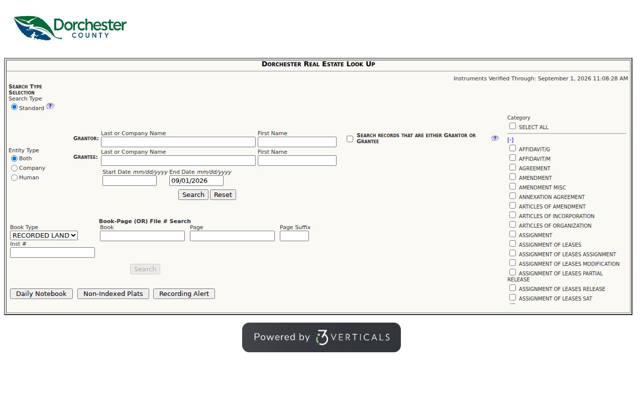
The index result should be treated as a pointer to the document. Confirm party roles and land details in the image or at the custodian before adding a transfer to the history.
Dorchester's 1897 Address Break
Dorchester County formed in 1897 from parts of Berkeley and Colleton counties. For previous residents research, that date is a genuine change in the records trail. The South Carolina Archives Dorchester guide identifies Dorchester conveyance books for 1897 to 1920, Berkeley conveyance transcripts for 1885 to 1897, and Colleton conveyance transcripts for 1867 to 1897. A present parcel in Dorchester may therefore require a parent-county source for an earlier transfer. The place name Summerville does not erase that older county record.
The same guide lists Dorchester auditor tax duplicates from 1897 to 1923, treasurer duplicates from 1899 to 1973, estate papers from 1897 to 1915, marriage books from 1911 to 1957, and marriage licenses from 1918 to 1950. Tax books can support a land-and-name timeline, while estate papers can identify a documented property transition. Neither source alone proves an address household.
The Archives guide names the dated record groups used to bridge this boundary.
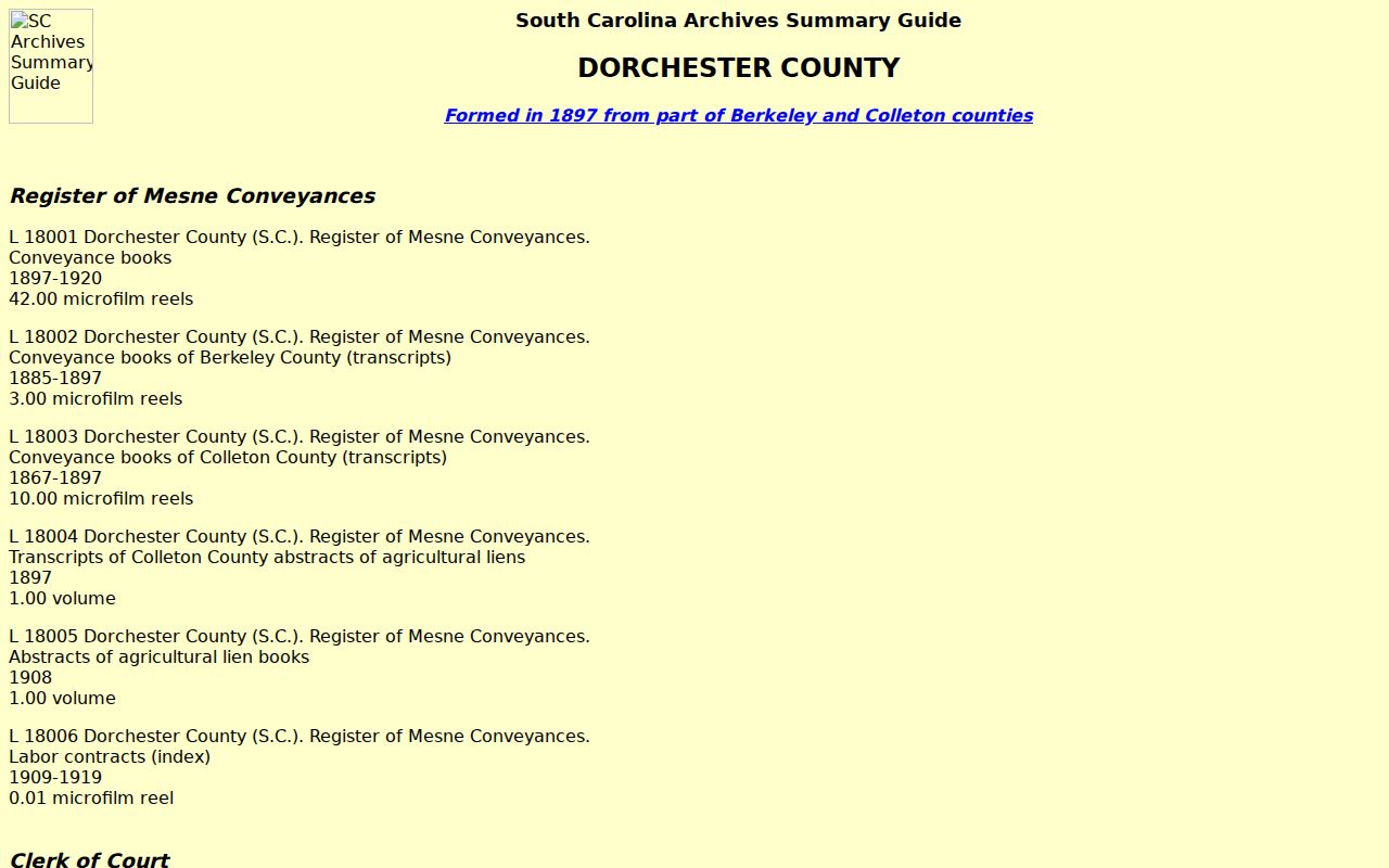
Write down the county, record group, book or reel reference, and years searched. Those details let a later researcher retrace the parent-county step.
Summerville Previous Residents Archive Room
When the online deed result ends, the local fallback is concrete. The Dorchester Register of Deeds maintains a land archive library for anyone researching documents recorded in that office. Its research hours are Monday through Friday, 8:00 a.m. to 5:00 p.m.; recording hours are 8:30 a.m. to 4:00 p.m. The office is at 201 Johnston Street in St. George. Bring the book and page, legal description, date range, and every prior citation already collected.
The ROD specifically warns that a record in processing may be absent from both the online and in-house system indexes. Ask the custodian about the exact document rather than assuming a gap means no record exists. For requests outside the ROD, Dorchester County’s FOIA process is most useful when it identifies the parcel, time span, and a particular public file. It does not require an office to build the entire title trail.
Summerville Previous Residents Household Evidence
Ownership is only one layer of an address story. No verified local source supplied a complete Summerville-wide reverse or criss-cross directory run, so a directory must be located and inspected before it is cited. The Dorchester County Library research service offers Ancestry Library Edition on library computers or Wi-Fi and HeritageQuest Online through eligible library-card access. Ask the reference desk for a specific city directory, telephone book, reverse section, microfilm item, yearbook, obituary index, or catalog record by street and year. The historic collections themselves are described on the Directory Book page.
Household sequence: verified address or legal description → dated directory entry, if a volume exists → closest released federal census → deed, tax, probate, or obituary source from the same period. The federal census is released through 1950, but the library provider page describes its own database coverage separately. Record the actual database, census year, place, and entry details used. A directory entry can be incomplete, and a census place label may not match an old street name exactly.
An obituary can help close a historic trail by naming relatives, life dates, service location, or town. The James A. Dyal Funeral Home has a named-person obituary search in Summerville. Treat a notice as family-history evidence, then pair it with an appropriate Probate, Archives, or DPH record where the question requires official confirmation.
Summerville Past Residents and Maps
Maps can date the setting around an address without identifying every person who was there. The Library of Congress Sanborn guide directs a researcher to search by South Carolina and Summerville, then record the returned catalog item, edition date, sheet count, notes, and digital-file availability. No trustworthy complete Summerville edition-year run was confirmed in the reviewed research, so verify each item before making a map-date claim. A Sanborn sheet can show a building footprint, material, label, and block layout.
The Timrod Library archive holds the Timrod Literary and Library Association Records from 1897 through 2025. Its clippings, photos, ledgers, correspondence, and institutional records are open for research subject to legal responsibilities. The collection is local context, not a personal-address index. Use it to understand a neighborhood institution or public event after the parcel and time period are already established.
The Timrod finding aid describes the archive and its research access.
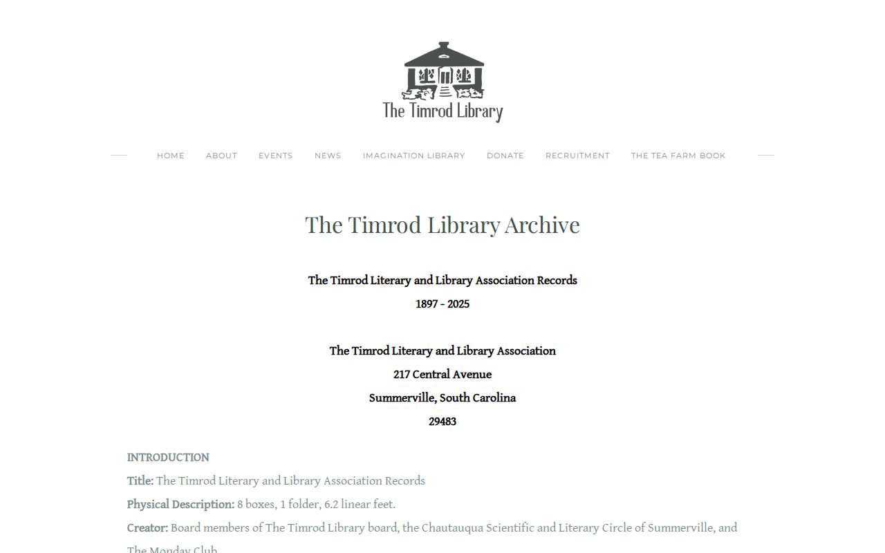
Local archives can make a property timeline more complete, but a document must still be read for its date, creator, and relationship to the address.
Annexation in Summerville Address History
A modern Summerville address can gain Town jurisdiction without changing the underlying land trail. The Town’s annexation process uses an owner petition with recorded deed and plat material, Planning Commission review, and a Town Council ordinance. The Town then notifies 911, fire, and tax offices. That sequence explains why a municipal permit, zoning, or Town archive record can begin later than a county deed or assessment record.
For a parcel near a Town boundary, first establish the county responsible for the property record. Then use annexation reports and Town Archive material as a dated municipal bridge. Do not discard a Berkeley, Charleston, or Dorchester record merely because the address now uses the Summerville postal name.
Limits on Summerville Previous Residents
Past residents research has real boundaries. A current owner may not have lived at the parcel, and a recorded party may be a lender, trustee, agent, or other non-occupant. Maps describe structures and blocks, not a household. A directory or obituary needs its own date and source review. South Carolina’s Address Confidentiality Program, protected or inactive voter status, confidential court material, and other records-law exemptions also mean that an absent entry cannot establish where a living person is or is not located.
Lawful use. Use a past-resident trail for family history, heir research, personal house history, or civic curiosity. Never use it to stalk, harass, track, intimidate, or harm a living person.